CHANGES IN THE ENVIRONMENTAL SITUATION IN THE TRANS-BAIKAL TERRITORY IN THE PERIOD FROM 2006 TO 2010
Nikolaeva Anna Georgievna
4th year student,
Department of Ecology and e. O. ZabGGPU them. N.G. Chernyshevsky, Chita
Voropaeva Tatyana Vladimirovna
scientific adviser, candidate of geographic sciences, art. teacher of the department of ecology and e. O.
ZabGGPU them. N.G. Chernyshevsky, Chita
The natural complexes of the region are extremely diverse, they have resources, the quality and quantity of which can provide the current and future generations of Transbaikalians, but are vulnerable to anthropogenic impact. Deterioration of the quality of the environment (growth of household waste dumps, decrease in soil fertility, etc.) is often associated with low ecological culture the local population, which actualizes the problem of improving the environmental education of all community groups, as the main factor in the sustainability of the relationship between nature and society.
The Trans-Baikal Territory, as a subject of the Russian Federation, is obliged to fulfill at the regional level the international and national obligations of Russia to preserve the unique habitats of migratory animals, to preserve the species listed in the international, national and regional Red Books, as well as natural complexes, including transboundary ones.
Therefore, the analysis of the environmental situation in the Trans-Baikal Territory in recent years is relevant and can become an information base or the basis for economic, economic, investment decisions for the Government of the Territory, various Ministries, departments, and structures.
During the work, the following goal was set: comparative analysis environmental situation in the Trans-Baikal Territory in 2006-2010.
Under the ecological situation is understood the specific state of the human environment, due to the interaction of nature and human economic activity.
The ecological situation is a spatio-temporal combination of various conditions and factors, including positive and negative in terms of living and human condition, that create a certain ecological situation in areas of varying degrees of well-being or disadvantage. Under the identification of environmental situations means: the establishment of a list (set) of environmental problems; spatial localization of environmental problems; determination of a combination (combination) of environmental problems and attribution of the identified area to one or another degree of severity of the environmental situation.
To determine the ecological situation, it is necessary to identify a number of factors that make up the ecological situation. Therefore, in our work, we have identified the following criteria for analyzing the environmental situation: the state of the atmospheric air of the territory, the state of surface and groundwater, waste generation and handling.
The results of observations in 2010 indicate that the level of air pollution in the cities of the Trans-Baikal Territory continues to be quite high. The main indicators of the state of air pollution in the cities of the region indicate that the highest average level of air pollution is characterized by the city of Chita, where the average annual content of benzo (a) pyrene exceeded the maximum permissible concentration (MPC) by 5.5 times, formaldehyde - by 4 times , suspended solids (dust) - by 1.6 times, which is due to the frequent recurrence of meteorological conditions unfavorable for the dispersion of air pollutants. The high average annual content of benzo(a)pyrene - 4.8 times higher than the MPC, was also observed in the city of Petrovsk-Zabaikalsky, and in 2008-2009. the average annual content of benzo(a)pyrene exceeded the MPC by almost 6 times, formaldehyde - by 4 times, suspended solids (dust) - by 2 times.
The main contribution to the total emissions of pollutants from stationary sources was made by enterprises for the production, transmission and distribution of electricity, gas, steam and hot water and mining companies.
A special place in air pollution is occupied by road transport, the number of which in the city of Chita and the Trans-Baikal Territory is increasing every year, and the volume of emissions is not taken into account in the statistical data. A large role in air pollution is made by cars with a long service life, including foreign-made ones, as well as cars with unregulated engines.
According to averaged data, in surface waters on the territory of the Trans-Baikal Territory (including the rivers of the basins of Lake Baikal, the Lena River and the Amur River) for 5 years, cases of exceeding the MPC of the following indicators were most often recorded: organic matter, compounds of copper, zinc, manganese, common iron, phenols and petroleum products.
The inconsistency of water quality with the hygienic standards of the rivers: Chita, Ingoda, Onon is due to the discharge of insufficiently treated and untreated domestic wastewater within the boundaries of populated areas; Argun - reset Wastewater in the territory of the People's Republic of China; Amazar - negative influence gold processing companies.
The main reasons for the low quality of drinking water in the region are: ongoing anthropogenic pollution of surface waters; factors natural character(increased content of iron and manganese compounds in the water of aquifers); absence or inadequate condition of zones of sanitary protection of water sources; use of old technological solutions for water treatment in conditions of deteriorating water quality; lack of a specialized service for the operation of water supply facilities; implementation of production control in a reduced volume; unstable water supply; deteriorating water supply networks.
Groundwater of various genetic types in the Trans-Baikal Territory is the main source of water supply, providing more than 90% of the population's need for drinking water in all areas, with the exception of the sparsely populated Tungiro-Olekminsky, where almost 100% of water consumption is carried out at the expense of surface water.
The most powerful object of groundwater pollution in the Trans-Baikal Territory is a series of tailings of the Priargunsky PCU along the Shirondukuy Pad, a lateral tributary of the Sukh Pad. Urulyungui. The tailings of the hydrometallurgical and sulfuric acid plant (cinder storage) are concentrated here, on the left side of the pad there is a sulfuric acid plant, a sulfuric acid warehouse, and heap leaching sites. The total area of the series of tailings is about 65 ha. After their creation, the level of groundwater along the Shirondukuy pad increased by 8.2 m in the mouth part and by 35 m in the central part. The total volume of leaks from these reservoirs is estimated at 9-10 thousand m 3 /day.
The negative impact on the geological environment of the objects of the energy complex (thermal power plants and heating plants) is associated with the filtration of industrial waters from hydraulic ash dumps, which causes pollution of groundwater and flooding of territories. These are the hydraulic ash dumps of the Chita, Krasnokamensk, Priargunsk, Sherlovogorsk thermal power plants, Kharanorskaya state district power station.
Since the Trans-Baikal Territory is a region of intensive development of mineral deposits, the main causes of water pollution are: tailings, technogenic water filtration from hydraulic ash dumps, dewatering at coal deposits.
The situation with the formation, use, disposal, storage and disposal of waste remains difficult in the Trans-Baikal Territory. The volume of production and consumption waste generated in the territory of the Trans-Baikal Territory is growing every year. The largest number waste in the Trans-Baikal Territory was observed in 2007, 2009, and the minimum - in 2006, 2008 and 2010.
Large enterprises that generate the bulk of waste in the territory of the Trans-Baikal Territory are JSC "TGC-14"; JSC PIMCU; OJSC "Novo-Shirokinsky mine"; OJSC Zhirekensky GOK; OJSC Zhirekensky FMZ; ZAO Rudnik Aprelkovo; CJSC Novoorlovsky GOK; OJSC "Silicate Plant"; artels of miners; military science, etc. A big problem is the collection and removal of consumer waste from residential areas.
On the territory of the Trans-Baikal Territory there is a single landfill for municipal solid waste in the city of Krasnokamensk. The operation of this landfill is carried out by UMP "Dorkomhoz". In the rest rural settlements the edges of the waste disposal site are represented by authorized landfills.
An analysis of the ecological situation in the territory of the Trans-Baikal Territory showed that it is rather tense. This is evidenced by the widespread deterioration of the state of atmospheric air, surface and groundwater in the Trans-Baikal Territory in all indicators for 2006-2010. Increasing waste generation and management.
Bibliography:
- State report "On the state and protection of the environment in the Trans-Baikal Territory for 2008 - 2009": - Chita, 2010. - 332 p.
- Report on the environmental situation in the Trans-Baikal Territory for 2010: - Chita, 2011. - 196 p.
- Sturman V.I. Ecological mapping: Tutorial/ IN AND. Sturman. - M.: Aspect Press, 2003. - 251 p.
Ecology (from the Greek oikos - dwelling, residence) - this is the science of the native home of mankind, the living conditions of those who inhabit it. In a stricter definition, ecology is a complex scientific directions, which studies the patterns of interaction between living things and the external conditions of its habitat in order to maintain the dynamic balance of the "Society - Nature" system.
In the past, man's use of the forces of nature and its resources was predominantly spontaneous: man took from nature as much as his own productive forces allowed. But the scientific and technological revolution confronted man with new problem- with limitation problem natural resources, a possible violation of the dynamic balance of the existing system, and in connection with this, the need for a careful attitude towards it. If, therefore, the past type of society's attitude to nature was spontaneous (and sometimes irresponsible) in nature, then in the new conditions a new type has arisen - the attitude of the global, scientifically based impact of society on nature with the aim of not only preserving it, but also reproducing it. Now it has become clear that the impact of man on nature cannot occur contrary to its laws. He takes possession of it not in spite of, but on the basis of knowledge of its laws. Visible dominance over nature, acquired by violating its laws, can only have temporary success, resulting in irreparable damage to both nature itself and man.
Human impact on nature tends to disturb the established balance of ecological processes. Humanity is facing problems that threaten its own existence. These include, first of all, air pollution, depletion and deterioration of the soil cover, and chemical contamination of the water basin. Thus, man, as a result of his own activity, came into sharp conflict with the conditions of his dwelling.
Acute awareness of the possibility of a global ecological crisis leads to the need for a reasonable harmonization of interactions in the system "technology - man - biosphere". At present, the global nature of environmental problems requires a different way of thinking from a person, new form his self-consciousness - ecological consciousness. First of all, this means that humanity must realize itself as a single whole in its relation to nature.
Among the problems of ecology, the central place is occupied by the state of the natural environment and natural resources, which is largely determined by the properties of natural systems. The landscapes of our - Chita region - with all their diversity, have some common features: low resistance to external influences, including anthropogenic, low productivity and slow self-healing. Among the reasons for this is the elevation of the territory above sea level and the mid-mountain relief, the location in the depths of the Asian continent, which causes a sharply continental climate. In the bowels of the region there are a large number of radioactive deposits (uranium and thorium) and radon waters. There are geochemical anomalies that cause endemic diseases (Kashin-Bek, Keshan, Graves, etc.). All of the above contributes to the deterioration of the environment and the violation of natural objects as a result of ill-conceived economic and other activities.
Zabaikalsky State National Park is a true pearl of Buryatia. The unique landscapes of the eastern coast of Lake Baikal, valuable natural complexes, the safety of which was under threat, prompted the Government of the RSFSR in 1986 to issue a decree on the creation of a state-protected park in this area.
Here is a real paradise for animals: more than 44 species of mammals, 50 vertebrates, 241 species of birds, 3 species of reptiles and the same number of amphibians. Many representatives of the fauna are included in the Red Book of Russia.
national park is part of a huge complex, a real repository of northern sights and natural beauties called the Reserve Podlemorie. It includes two more parks - the Frolikhinsky Reserve and All three nature protection zones are part of the Lake Baikal object, which is under the protection of UNESCO.
Park Features
The territory of the protected zone covers the Akademichesky, Sredinny, Svyatonossky and Barguzinsky ridges and occupies a total of 269 thousand hectares. 37 thousand hectares is the water area of Lake Baikal, the deepest freshwater lake in the world.
Most of the reserve complex is occupied by mountain slopes, abundantly covered with thickets of dwarf birch, dwarf pine, larch, pine and cedar taiga.

One of the most beautiful places is the Holy Nose Peninsula: the Chivyrkui Isthmus connects it with the eastern coast of Lake Baikal. The top of the Akademichesky Ridge, which is the underwater boundary between the northern and southern basins of the Baikal Basin, is represented by the Small Ushkany Islands and the Big Ushkany Island.
This formation is called an archipelago.
Chivyrkuisky Bay
The Zabaikalsky National Park is famous for the largest freshwater seal rookery in Baikal. This is an endemic of Baikal and the only representative of the order of pinnipeds. Most of the seals are found on the Ushkany Islands, where their number sometimes reaches 2500 - 3000 individuals. In autumn, during storms, seals (most often pregnant females) move to Chivyrkuisky Bay. However, this is not their winter hut: having healed and rested, the seals again move into open water, as the bay is covered with ice.
The bay is famous for its thermal springs, the most famous of which is the Serpent. It owes its name to the population of the common grass snake that lives in the Arangatui swamps. The water temperature in the spring sometimes reaches +50-60 degrees. Mineral springs Nechaevsky and Kulinye bogs are also popular among the guests of the park.
The shores of the Chivyrkuisky Bay are heavily indented, the waters cut into the land for 25 kilometers. This feature led to the fact that along the entire reservoir appeared small sandy bays protected from the winds up to five meters deep. One of the most remarkable is Ongokon Bay.

Five tourist routes enable guests to get acquainted with the inhabitants of the protected area, its beauties and breathtaking landscapes. From the highest point of the park - Mount Markovo, located on the Svyatoy Nos peninsula, an amazing panorama of the area opens up.
Islands and park
The nature of Buryatia is diverse and beautiful in any of its manifestations. So, taking a boat trip along the Chivirkuysky Bay, you can admire the real islands, the steep banks of which have turned into a refuge for numerous blue-gray birds that build their nests here.
Climatic features of the park
The park is located in the Central Baikal eastern climatic region, which is characterized by a continental climate with warm, sometimes dry summers and long cold winter. The influence of Baikal softens weather conditions in the coastal part of the protected area. The average temperature in winter is -19 degrees Celsius, in summer +14 degrees. The water temperature in the lake does not rise above +14 degrees even on the hottest days.
Water resources of the reserve
The Zabaikalsky National Park is rich in water resources. Many small rivers flow here, among which the Big Chivirkuy, Malaya and Bolshaya Cheremshana stand out. The basins of these rivers are closed, so they carry their waters to Baikal. There are also lakes here: the largest of them are Arangatui and Small Arangatui, located on the Chivyrkui Isthmus and connected to the bay. Bormashovoye Lake is smaller and is known for its mineral waters.

A feature of the park is the presence of karst lakes - there are more than twenty of them.
Flora of the Zabaikalsky National Park
The Trans-Baikal Territory is located in the zone of taiga forests, which directly affects the structure of the vegetation cover in this area. It is due to the vertical zonality of the Trans-Baikal mountainous regions. The forests mainly consist of coniferous trees: Gmelin larch, Siberian fir, pine, cedar and elfin cedar.
A small area is occupied by deciduous forests, mostly represented by stone and broad-leaved birches and aspens.
The Trans-Baikal National Park is distinguished by an unusual distribution of mountain taiga forests compared to their location in the continental Siberian mountains. So, in the park, the number of cedar-larch and larch trees is relatively small - their area occupies about 14 thousand hectares, and they are located on madders along river terraces, while in other Siberian forests such trees are represented in the majority.
Endemics and relics
The flora of the protected area is diverse, many plant species are endemic and relict. The most valuable of them settled in the highlands of the Ushkany Islands and the Holy Nose.

These include Chozenia, communities of Siberian dwarf pine and dwarf dwarf birch, and Teeling's Borodinia.
fauna diversity
The Trans-Baikal National Park has become a real home for sables, wolves, wolverines, bears, foxes, squirrels, elks, brown bears, red-gray voles, hazel grouses, nutcrackers, musk deer, black-capped marmots and many other representatives of the fauna. Animals here feel completely safe.
Among representatives of amphibians there are rare species - Siberian and Moor frogs. Six species of reptiles also found here include the grass snake, muzzle and viviparous lizard.
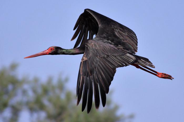
Among the birds, both sedentary and vagrant, one can meet white and yellow wagtails, brown-headed chickadees, Muscovites, Dubrovniks, nuthatches, nutcrackers, lapwings, snipes, blackies, river terns, gray and silver gulls. Sometimes in the park you can see a black stork (whose nesting site is still a mystery), golden eagle, white-tailed eagle, peregrine falcon and osprey.
Another rare bird that has disappeared from the coast of Lake Baikal and lives in small numbers in the Chivyrkuisky Bay is the great cormorant.
Many species of birds arrange their nests in swamps, hidden from human eyes and located mostly on the Chivyrkui Isthmus. The least transformed ecosystem of the world is also located here - the Arangatui swamps, which are inhabited by elk, capercaillie, and muskrats.
The most numerous is the group of waterfowl, represented by the common mallard, goldeneye, pintail, whooper swan, teal whistle and
There are also owl-like birds in the park: marsh and long-eared owls, eagle owls and snowy owls - very rare guests, found only in winter or in places where the human foot rarely steps.
National parks Buryatia, including the Zabaikalsky National Park, are rich in various representatives of the underwater world. So, in the reservoirs there are perch, ide, Siberian grayling, dace, burbot, sturgeon, pike, roach and an endemic species - a small golomyanka.
Zabaikalsky National Park: how to get there
The closest settlement to the park is the village of Ust-Barguzin.
You can get here by land or water. The optimal route by land is the services of private transport, which departs from Irkutsk along the coast of Lake Baikal. From the capital of the Republic of Buryatia - the city of Ulan-Ude - you can get to the park by taxi or regular bus.
The distance to the reserve is about 275 km and the journey takes about 5-6 hours.
Keep in mind that most of the way passes on a gravel road. For people who prefer the water route, private flights depart from the port of Baikal, as well as from the villages of Khuzhir, Nizhneangarsk and Listvyanka.
Having visited this park, you will not regret it for a minute, because it is not only calling card Baikal, but also a real oasis of natural wonders, which are so rich in the Trans-Baikal Territory!
Mustafina Roxana
Project work on local history touches upon the main environmental problems of the Trans-Baikal Territory. Transbaikalia is an amazing and unique region. This is the pantry of the natural wealth of our Motherland. We must protect and protect our land.
Download:
Preview:
Municipal budgetary educational institution
Yasninskaya average comprehensive school №1
Project work
« Ecological problems Trans-Baikal Territory"
Completed by: Mustafina Roxana
4th grade student
Head: Yachmeneva A.M.
2017
- Introduction.
- Ecological problems of the region.
3. Conclusion.
5. List of references.
Introduction.
Spring has come. We are happy for everyone sunny day We make plans for the future. And what is our future? What lies ahead for us?
Today I want to draw your attention to the problems that affect every person, to the state of our nature. Many years ago, man began to use nature to obtain fruits and berries, to kill animals to obtain meat and skins.Currently, natural resources are depleted, nature is heavily polluted. We are surrounded
many environmental problems.
What are environmental problems? This is a change in the natural environment as a result of human activity, leading to a violation of the structure and functioning of nature.
We live in an amazing region. The Trans-Baikal Territory is located in the southeast of Siberia, with an area of 431.5 thousand square kilometers, it occupies 4% of the territory of Russia.
Transbaikalia is beyond Baikal,
This is where the hills and taiga are.
This is where the snow on the passes,
Where a blizzard rages in winter.
It is impossible not to fall in love with nature here.
There is no more beautiful and harsher land.
Once you see, you will dream for a long time
Transbaikalia is earthly beauty.
The purpose of my work: to characterize the ecological situation of the Trans-Baikal Territory
Tasks: to consider what environmental problems exist in the Trans-Baikal Territory, to give a brief description of them.
Today, the ecological situation in the world can be described as close to critical. Global problems:
Thousands of species of plants and animals have been destroyed and continue to be destroyed;
The forest cover has been largely destroyed;
The available stock of minerals is rapidly declining;
The world ocean is not only depleted as a result of the destruction of living organisms, but also ceases to be a regulator of natural processes;
The atmosphere in many places is polluted to the maximum permissible extent, and clean air is becoming scarce;
The ozone layer, which protects against destructive cosmic radiation for all living things, is partially broken;
Surface pollution and disfigurement of natural landscapes
Consider how things are in the Trans-Baikal Territory.
The main branches of industry in Transbaikalia are mining, fuel and energy, and transport. In terms of resources, this is the richest and oldest mineral resource region of the country. There are 143 mining enterprises in the region. As a result of the activities of these facilities, 119.1 million tons of waste is generated in the region.
atmospheric air.
Results of observations in 2012-2016 indicate that the level of air pollution in the cities of the Trans-Baikal Territory continues to be quite high.
According to statistical data, the number of emission sources on the territory of the region with established emission standards is about 8000 units (7995).
About 125-130 thousand tons of pollutants are emitted into the atmosphere every year.
The most polluted city in the region is Chita due to geographical location and prevailing calm weather.
Analysis of atmospheric air pollution by seasons of the year shows that the highest levels of pollution are constantly observed in the autumn-winter periods. This is due to both the characteristics of the heating season and the climatic and geographical features of the area. Emissions of pollutants into the atmospheric air from stationary sources for last years decreased slightly, this is due to the introduction of gas cleaning equipment at enterprises.
Many boiler houses are operated with faulty gas cleaning equipment, or do not have it at all. To ensure the quality of atmospheric air, constant state control, improvement of technological processes, construction and commissioning of new dust-collecting installations, increasing the efficiency of existing installations and eliminating sources of pollution are required.
Water resources.
According to integrated assessment surface water quality in terms of hydrochemical indicators in 2014, out of 35 water bodies in the Trans-Baikal Territory, 21 water bodies (or 60%) had polluted and very polluted waters. There are 11 (or 31%) water bodies classified as dirty and very dirty. In addition, in 2014 the waters of the Chernaya, Cherny Uryum and Ungo rivers were classified as slightly polluted. There were no water bodies with extremely dirty waters in 2015.
According to the results of stationary observations, r. The Argun is still one of the most polluted water bodies in the Trans-Baikal Territory.
According to the water quality Shilka are characterized as polluted and very polluted (in 2013 the waters of the river were classified as dirty).
Compared to 2013, the water quality of the Onon River has improved throughout the observation area. The waters of the river from the category of dirty passed into the category of polluted in the section of the river with. Upper Ulkhun - st. Tin and slightly polluted - in the area with. Chiron.
Water pollution along the Ingoda River is not uniform. Compared to 2012-2014 The river water quality has improved somewhat.
In the control section, the waters of the Chita River are characterized as very dirty.
Compared to previous years, the level of pollution of the river's waters has slightly decreased.
Compared to 2013, the water quality of the Nercha River has slightly improved. River water quality Amazar remained at the same level - the waters are dirty.
Compared to 2013, the water quality of Lake Kenon has improved slightly.
The discrepancy between water quality and hygienic standards for the rivers Chita, Ingoda, Onon is due to the discharge of insufficiently treated and untreated domestic wastewater within the boundaries of populated areas; along the Argun River - by the discharge of wastewater in the territory of the PRC.
First of all, the low quality of water bodies depends on insufficiently treated surface runoff.
Hydraulic structures.
Reliable protection of settlements and other territories from floods is urgent task for the Trans-Baikal Territory. And it is no coincidence that in such a landmark document for the water industry as the Water Strategy of the Russian Federation, Transbaikalia is designated as a flood-prone region.
Floods are the most common natural disasters in the Trans-Baikal Territory, and during high-water periods occur almost annually in certain areas. A significant part of the settlements of Transbaikalia is located in the floodplains of the rivers Ingoda, Chita, Onon, Shilka, Argun, i.e. in flood-prone areas. More than 200 settlements fall into the flood zone, about 100 of which are subject to regular flooding.
The most effective measures to combat such emergencies are preventive measures, namely the implementation of certain water management measures:
Construction of hydraulic structures,
Capital repairs of hydraulic structures,
As well as measures to increase the capacity of riverbeds.
Wastes of production and consumption.
A significant amount of production and consumption waste, including toxic ones, has accumulated and continues to accumulate in storage facilities, storage facilities, warehouses, landfills and other facilities.
The bulk of waste of hazard classes 4 and 5 is produced by enterprises extracting minerals (mining industry). Technogenic accumulations (about 2.9 billion tons) are formed by dumps of poor and substandard ores, products of chemical processing of non-ferrous metal ores. The imperfection of the technology, the monomental approach to the development of the subsoil led to the fact that these wastes, in fact, are mined from the subsoil and crushed ore.
The total volume of municipal waste accumulation is 157 thousand tons/year. Waste is placed in 372 "dumps" that have been operating since Soviet times. In the region since November 2016. the installation and trial run of the waste sorting plant Zabspetstrans LLC with a capacity of 100 thousand tons / year was carried out. The commissioning of the waste processing plant is scheduled for April 2017. Neutralization and disposal of waste is carried out by about 10 Forsage installations.
Forest resources of the Trans-Baikal Territory
The quality and condition of the region's forest resources are significantly affected by industrial logging and fires. The area of forested land is decreasing, natural regeneration is slow, artificial reforestation is being carried out, but the condition of forests is deteriorating. The areas and stocks of coniferous species are declining, while those of small-leaved species are increasing. Indigenous types of forests are replaced by less valuable derivatives. Timber harvesting volumes have been reduced everywhere since 1991.
The smallest change in the state of the forest fund is noted in the northern forestries of the region (Charsky, Tungokochensky, Tungiro-Olekminsky), where economic activity is developed to a limited extent.
Soils and land resources of the Trans-Baikal Territory
A large degree of development (plowing) of the territory, violation of agricultural technology, unsystematic grazing in combination with natural and climatic conditions (mountainous terrain, the predominance of soils of light mechanical composition, dry spring and strong winds) led to the development of erosion processes. Pastures and hayfields need radical improvement, but it is practically not carried out. In order to restore and improve soil fertility, increase agricultural production, programs have been developed that include a complex of agrotechnical, reclamation, cultural, technical and agrochemical works, as well as soil protection from erosion. Due to lack of funds, all activities are not carried out.
specially protected natural areas.
The Trans-Baikal Territory stands out among the Siberian regions for its unique natural characteristics. The richest landscape and biological diversity has been formed here over tens and hundreds of thousands of years under the influence of harsh climatic and peculiar physical and geographical conditions.
The most effective way to preserve valuable natural systems is to create a unified network of protected areas.
In the Trans-Baikal Territory, the area of specially protected natural areas is 2,573,062 hectares (5.96% of the total territory of the region). The list of protected areas of federal and regional significance located on the territory of the Trans-Baikal Territory includes 2 state natural biosphere reserves, 2 national parks, 18 state nature reserves (including 2 of federal significance) and 65 natural monuments (including 1 monument nature of federal significance), a total of 89 natural areas of different categories.
Conclusion.
Transbaikalia is an unusually rich and diverse land of unique contrasts and surprises. This corner of continental Asia combines the harsh climate of Transbaikalia with deep blue sky, a unique view of snow-capped mountain peaks, the beauty of mountain taiga, wide stripes of forest-steppes, many transparent mountain rivers and lakes - all this forms an amazing natural environment, captivating a person who first comes to this region. We are simply obliged to save our land for us and our descendants!
It's time for humanity to understand
Taking riches from Nature,
That the Earth must also be protected:
She, like us, is the same - alive!
... Now we dry it, then we water it,
We use so much fertilizer
That we ourselves are afraid to die.
So what the Earth must endure.
And how many emissions we give her
Smoke from factories, dirt from ships...
We have a beautiful Land of Humans,
I'm afraid it wouldn't become the Land of Waste!
Literature.
1.Geography of the Trans-Baikal Territory: Textbook. -Chita: Express publishing house, 2009.-308s.:ill.
2. Report of the State budget institution"Zabaikalsky regional environmental center» 2015
3. Internet resources.
in the presence of solonchaks and solonchakous soils. In the vegetation cover of the reserve, composed mainly of steppe and halophyte-meadow communities, halophyte vegetation plays a significant role. The most common are leimus and four-grass steppe communities, beskilnitsa and creeping sedge halophyte-meadow, as well as meadow-steppe communities with the dominance of leimus and milky-white iris. The floristic saturation of the communities is relatively low. The peculiarity of the flora of the region is given by species associated with saline soils and petrophytes. The flora and vegetation of the Daursky Reserve have not been fully identified by us and need further detailed study. It is advisable to expand the buffer zone of the reserve to better cover the diversity and effective protection of steppe communities.
Bibliography
1. Walter G. Vegetation Earth Globe. M.: Progress, 1975. T. 3. 462 p.
2. Vlasov N. A., Chernyshov L. A., Pavlova L. I. Salt Lakes Eastern Siberia and the possibility of their industrial use // Tr. Buryat. complex scientific research. in-ta: Ser. "Biol.-soil". 1960. Issue. 4. S. 56-78.
3. Frish V. A. Landscape research in the Soviet Barga. L .: Nauka, 1967. Issue. 1. T. 99.
BBK E080 (2Ros - 253.5)
O. K. Kirilyuk
Improving the network of protected areas in the Trans-Baikal Territory in the context of climate change as a factor in sustainable socio-economic development of the region
The article analyzes state of the art and prospects for the development of a network of specially protected natural areas (SPNA) of the Trans-Baikal Territory in the context of climate change. The tendencies of changes in the ecosystems of the steppe and forest-steppe zones of Eastern Transbaikalia under the influence of natural and anthropogenic factors are discussed. The role of the network of protected areas as the basis for the formation of sustainable nature management in the region is shown.
Keywords: Eastern Transbaikalia, climate change, dynamics natural ecosystems, specially protected natural areas (SPNA), a network of protected areas.
Improvement of SPNA network in Zabaykalsky kray as a factor of the region's socio-economic sustainable development in conditions of the climate alterations
The paper studied current state and perspectives of development of special nature protected areas (SPNA) network of Zabaykalsky kray in conditions of climate changing. Tendencies of dynamics of steppe and forest steppe ecosystems depending of natural and anthropogenic factors are discussed. The role of SPNA network as a basis of sustainable development in the region is shown.
Key words: Eastern Transbaikalia, climate alteration, dynamics of nature ecosystems, special nature protected areas (SPNA), SPNA networks.
At the beginning of 2010, there were 95 specially protected natural areas in the Trans-Baikal Territory, covering an area of 1694.139 thousand hectares (or 3.92% of the territory of the region). Seven specially protected natural areas (two biosphere reserves, two federal nature reserves, a national park, a natural monument and a resort) have federal status, the remaining 88 (15 reserves, 65 natural monuments, 8 resorts and medical
recreation areas) - regional status. At the same time, regional protected areas occupy about 1009.4 thousand hectares or 2.3% of the territory of the region.
Compared with the neighboring subjects of the Russian Federation and the regions of Mongolia and China bordering the region, the Trans-Baikal Territory stands out for an insignificant share of land occupied by protected areas. This figure is lower (3.6%) only in the Irkutsk region (Fig. 1).
Rice. 1. The share of lands under specially protected natural areas in some constituent entities of the Russian Federation and the regions of Mongolia and China neighboring the Trans-Baikal Territory (built using these sources)
*The proportion of land under protected areas is shown only for the Argun river basin
The location of specially protected natural areas in the Trans-Baikal Territory is uneven, reflecting the degree of exploration of the territory, and, in part, the history of the development of the region. Most of the protected areas were created in the 70-80s. of the last century, mainly in the developed areas of the central part and south of the region in order to ensure the protection of rare species, the reproduction of game animals and the preservation of especially valuable or remarkable natural objects. Ensuring representativeness (presence in the protected areas of all landscapes and key ecosystems represented in the region) as a guarantee of maintaining the overall stability of the natural complexes of the region until the 2000s. did not seem to be the task of forming a regional environmental network.
An analysis of the modern network of protected natural areas of the Trans-Baikal Territory shows that it does not adequately cover the ecosystems of various natural zones, including especially valuable and endemic communities (for example, black birch steppe forests of the lower Argun region). In the northern regions of Eastern Transbaikalia, which are distinguished by a special originality of ecosystems, the presence of many rare species of flora and fauna, as well as a high tourist potential, areal protected areas high categories(reserve, national park, sanctuary) are absent today. As a result, 29% of animal species and 46% of plant species included in the regional Red Book are not represented in protected areas. The least protected areas cover the forest-steppe - protected areas occupy only 2.69% of the territory of this natural area. Moreover, the main area of legally protected lands falls on the districts of sanitary protection of resorts, for which the conservation of biological diversity is not the main task. At the same time, it is the Trans-Baikal forest-steppe that many experts call among the samples of zonal ecosystems, the representation of which in the protected areas of federal status is necessary to ensure the representativeness of the federal network of protected areas. In the mountain taiga and steppe zones, protected areas occupy 4.58% and 4.77% of the total land area in the region, respectively (including protected areas of nature reserves).
In 2003-2005 a team of authors carried out work to identify areas and ecosystems that are especially significant for maintaining the ecological balance on the territory of the Trans-Baikal Territory, and identified promising territories for the formation of new protected areas. When performing the work, not only the environmental value was taken into account, but also the significance of the designed protected areas for the sustainable socio-economic development of the adjacent territories and the region as a whole. In table. 1c summarizes the main tasks and principles of building a network of specially protected natural areas in Transbaikalia, taking into account the natural and socio-economic characteristics of the region.
Table 1
Features of the formation of a regional network of protected areas in the Trans-Baikal Territory
Main tasks: Basic principles:
Ensuring the ecological safety of the region (through maintaining the sustainability of ecosystems); Ensuring monitoring of ecosystems and individual species to obtain an objective assessment of their condition; Providing conditions for the development of sustainable areas of economy, recreation, the traditional way of life of indigenous peoples Ensuring representativeness (coverage of all major types of ecosystems); Taking into account the ecological features of the territory (ecological significance, dependence of the state of natural complexes on cyclical climate changes, the transboundary nature of ecosystems, the presence of globally significant ecoregions, etc.); Accounting for the socio-economic characteristics of the region (raw-material orientation of the economy, the border peripheral position of the region, relatively low level life of the population and its high dependence on the state of natural resources, other)
The specificity characteristic of Transbaikalia, indicated in the basic principles of the formation of the network of protected areas of the region, implies the need to perceive the network precisely as a component of the infrastructure for the socio-economic development of the region. Transbaikalia is rich in natural resources. Moreover, their significance is assessed not so much from the point of view of the balanced development of the region, but from the point of view of the traditional demands of the center of the country, and in recent years - the interests of the closest neighbor - China. This is due both to the peripheral position of the region relative to the main economic and political centers, and to the lack of an adequate marketing assessment of the prospects for the development of alternative to traditional (based on mining and logging) sectors of the economy. As a result, the region is losing the richness and diversity of the so-called "renewable", as well as universal natural resources, the value of which in modern world increases faster than monotargets. For example, according to I. E. Mikheev, due to the degradation of habitats due to anthropogenic impact (destruction of spawning sites, fish migration routes, poaching, etc.), 58 species have dropped out of the ichthyofauna of the region or are on the verge of complete destruction and subspecies of fish, first of all - especially valuable in commercial value. A catastrophic situation has been developing in the last two decades with forest resources. Decrease in the quality of forest land, high level poaching explains the decrease in the total number of hunting species. In most hunting grounds located in the central and southern parts of the region, the number of the main hunting species: roe deer, red deer, elk, hare, game birds is below scientifically based minimum limits sufficient to allow recreational hunting. The same trend is observed in the northern regions.
So far, the specifics of the natural dynamics of Daurian ecosystems have not been taken into account in the organization of the economy. The region is characterized by a cyclical (on average 30-35 years in duration) change of periods of moisture. Dry periods are accompanied by shallowing of rivers and lakes, a decrease in the level of groundwater, an increase in the number of fires, etc. As a result, the resistance of ecosystems to various
anthropogenic and natural influences. The cyclicity of moisture and the problems associated with it are most clearly manifested in the steppe and forest-steppe zones of the region.
The last dry period began in 1999 and continues to the present. Compared to the previous ones, it is characterized by higher average annual and summer temperatures, which contributes to more severe dehydration of the territory. Periods of insufficient moisture are extreme for most species of near-water and waterfowl, and many species of mammals. With the drying of water bodies, xerophytization of plant communities occurs, migration routes and concentrations of migratory, near-aquatic and waterfowl change and narrow, and migrations of ungulates become more active. The habitats of such primordial steppe species as bustard, demoiselle crane, white-naped crane are shifting to the forest-steppe, the concentration of waterfowl in the floodplains of large rivers is growing.
The last thesis is most clearly illustrated by the situation on the river. Argun. With the drying of the Torey lakes, the wide valley floodplain of the Argun, where the riverbed has many branches and there are more than a dozen floodplain lakes and oxbow lakes, becomes the main place for the concentration of birds during migration. Naturally, any anthropogenic pressure at this time in places where birds are concentrated can cause a sharp decrease in the number of migratory and nesting semiaquatic and waterfowl species in Dauria. As a result of various anthropogenic impacts for 2003-2008. the total number of birds on the Argun has decreased by more than 5 times. This has had an impact on the overall decline in the number of waterfowl throughout Transbaikalia.
On fig. 2 shows the change in the range of the Mongolian gazelle over the past decade. As can be seen from the figure, the range is shifting to the north, which coincides in dynamics with the northward movement of the boundaries of the steppe zone. For gazelle, the shift of the range towards Russia is fraught with many risks. The population density in Russia is higher than in Mongolia, the level of poaching outside protected natural areas is traditionally high. Taking into account the decline in the number of antelope in the last decade in Mongolia, it can be assumed that without the introduction of special measures to protect the habitats of the dzeren, both in Mongolia and in Russia, the rate of decline in the number of the animal will increase.
Cyclical climate fluctuations in Dauria are superimposed on the overall process of climate change in the region. Over the past 50 years, there has been a steady upward trend in air temperature. Thus, the isotherms that determine the spread of permafrost (-2.5 °С - the southern border of distribution; -7.5 °С - the border of continuous permafrost) are actively shifting to the north. Over the past 40-50 years, the displacement has amounted to several hundred kilometers in places. The southern limit of the permafrost distribution has risen above 52 ° north latitude, approaching the limit of permafrost retreat during the geologically known interglacial periods. The retreat of permafrost is accompanied by a decrease in the level of soil during the dry period.
Rice. Fig. 2. Changes in the northern border of the range of the Mongolian gazelle (Pgosarga gutturosa) in the 21st century (according to V.E. Kirilyuk, unpublished data). 1 - range of gazelle before 2000; 2 - range of dzeren in 2010
water, which, together with insufficient air humidity, leads to additional drying of the soil. As a result, the process of advancing the borders of the steppe zone to the north is activated. A peculiar indicator of this process is the widespread drying of forest belts in South-Eastern Transbaikalia. Comparison of the processes taking place in the southern regions of the Trans-Baikal Territory and in the adjacent territories of Mongolia and China allows us to conclude that the aridization process has intensified in the steppe zone of Dauria.
In such conditions, the increase in any production associated with an intense impact on ecosystems in the steppe and forest-steppe zones is fraught with their rapid degradation and deterioration in the quality of life of the population. A similar picture could be observed in the south of the Chita region in the late 70s and early 80s of the last century. The artificial increase in the number of sheep in the steppe zone during the dry phase of the climatic cycle (1970-1978) and their overcrowding led to rapid degradation of pastures and, as a result, to a rapid decline in the number of sheep. For the period from 1979 to 1986. the total number of sheep in Transbaikalia decreased by a third. At this time, more than 25% of the pastures were in the last stage of failure, preceding desertification. The steppe plowing during the dry period contributes to the strengthening of soil erosion processes. Violation of the turf layer, which ensures the preservation of moisture and the bonding of scarce soils of dry steppes, leads to drying and depletion of soils during periods of long-term drought, and attempts at large-scale irrigation lead to their rapid salinization. Despite the multiple decrease in the area of arable land and the number of small cattle in Transbaikalia since the late 80s, the share of eroded agricultural land in the Chita region in 2004 was 10.7%.
According to the Gibbs theory of urbanization stages, the Trans-Baikal Territory is currently at the 3rd stage of urbanization, which is characterized by the concentration of population and production in large settlements with the fading of production in the periphery. For such territories that have preserved natural ecosystems, the basis of the conservation strategy and socio-economic planning is the preservation of the maximum area of undisturbed natural ecosystems, since the preservation of the initial level of biodiversity for the territory (from species to ecosystems) is the key to the possibility of its sustainable development. In our opinion, a full-fledged system of specially protected natural areas can not only ensure the preservation of the natural framework of Transbaikalia, but also give impetus to the manifestation of a qualitatively new character in the development of the region's economy.
Modern legislation in the field of specially protected natural areas makes it possible to use various categories of protected areas as a basis for organizing the rational use of the universal natural resources most in demand in the modern world - water, land, and biological resources. Each of the categories of protected areas has specific tasks that collectively allow creating a basis for organizing rational nature management: scientific (through the activities of nature reserves and partly national parks), environmental protection (all categories of protected areas), reproduction (mainly the categories “reserve”, “zakaznik”), educational ( nature reserves, national parks) and tourist and recreational (national and natural parks, health-improving areas and resorts, natural monuments).
The specifics of the dynamics of the natural steppe and forest-steppe ecosystems of Eastern Transbaikalia and the nature of their use suggest the establishment of a special regime in a number of protected areas, which can also be carried out within the framework of existing legislation. IN critical periods, when the role of certain ecosystems in the conservation of biodiversity increases, more stringent restrictions on economic activity may be established compared to the favorable period. The most promising is the establishment of such a regime in wetlands: steppe lakes and in floodplains of rivers that are part of wildlife preserves or biospheric polygons of biospheric reserves.
Biosphere reserves existing in the region should be given special attention. The structure and tasks of such protected areas are most in line with the interests of the development of especially valuable natural areas, since they provide for active cooperation between the reserve and the local community to ensure a balance of environmental and economic interests. In particular, carried out by reserves Scientific research based on maintaining long-term continuous series of observations of natural natural processes, can also be oriented towards solving specific requests and needs of local economies. The regulation on UNESCO biosphere reserves provides for the organization of cooperation zones around them, within the boundaries of which protected areas actively contribute to the creation of a system of rational, sustainable use of natural resources. We can talk not only about supporting the traditional direction - the development of tourism, based on showing the sights of the protected area open to the public, but also about supporting projects for the development of farms, other industries that use technologies that do not or only slightly disturb natural ecosystems. Let us make a reservation right away that we do not mean direct financing by the reserve for the creation of certain industries, farms or infrastructure, but the use of its scientific potential and the status of a particularly valuable natural area. In many countries of the world, the zones of cooperation of biosphere reserves are actually special development zones, to solve the problems of which not only regional, but also national and international resources are involved. A number of international programs are also aimed at implementing the ideas for the development of such zones, including the UN GEF development projects, the TASIS program, etc.
The first step in the implementation of the strategy of biosphere reserves in Transbaikalia was the project of organizing a cooperation zone for the Daursky Biosphere Reserve in six steppe regions of the south of the Transbaikal Territory (Fig. 3). Here, the creation of such a zone has a special meaning. The Argun area, which is of key importance for dozens of globally rare species of fauna, is currently experiencing a number of environmental and social problems associated with climate change, as well as the active actions of the Chinese side to redistribute the flow of the Argun River. It is necessary to carry out a comprehensive assessment of the possible consequences of the implementation of economic projects in the light of climate change, as well as to develop a program for the socio-economic adaptation of the Argun region to these changes. Such work can be carried out within the framework of the concept of the biosphere reserve cooperation zone.
According to the definition of environmental risk, first of all, the creation of protected areas requires territories that have both high conservation value, low sustainability and richness of natural resources. Such characteristics are inherent in many ecosystems in Transbaikalia. In recent years, the forest-steppe zone of the region, which plays the role of the main refugium of the biota in dry periods, has been in the zone of special risk. In the coming decades, the region will retain the resource orientation of the economy, which will inevitably contribute to further degradation of the natural environment.
Rice. 3. The zone of cooperation of the biosphere reserve "Daursky": 1 - the territory of the reserve "Daursky";
2 - protected zone of the reserve; 3 - reserve of federal significance "Tsasucheisky Bor"; 4 - zone of cooperation of the reserve; 5 - reserves of regional importance
environment. In this situation, it is necessary to create a network of "compensatory" protected areas that ensure the protection of the most valuable ecosystems before the start of active development of the territory.
In 2003-2009 in Transbaikalia, nine specially protected natural areas of the categories "national park", "natural park", "zakaznik", "reserve", "natural monument" were designed. Of these, only three have been created and received a conservation status (within the boundaries of the ABAO) (Table 2). The creation of the rest stumbles upon opportunistic barriers or objections from economic structures. At the same time, the territories of future protected areas turn out to be unprotected from intensive economic exploitation and gradually lose their conservation value.
table 2
Development of a network of protected areas in the Trans-Baikal Territory in 2000-2010
Name of the projected protected area Year of project preparation Municipal area Current state
Natural monuments of regional importance:
Sakhanai 2008 Duldurgin PA since 2008
Reserves of regional importance:
Mountain steppe 2003 Kyrinsky protected area since 2003
Aginskaya steppe 2003 Aginskiy PA since 2004
Relic oaks 2004, 2008 Gazimurozavodsky Not created
Semenovsky 2008 Baleisky Not created
Natural parks:
Ivano-Arakhleysky (on the basis of the reserve) 2008 Chitinsky Not created
Reserve of federal significance:
Dzeren Valley 2009 Borzinsky, Zabaikalsky Not created
National parks:
Chikoysky 2003, revised in 2008 Krasnochikoysky Not created
Reserve:
Argun site (biosphere polygon) of the Daursky Reserve 2006-2009 Zabaikalsky, Krasnokamensky, Priargunsky Not created
The issue of ensuring the protection and main activity of the existing network of regional protected areas in the Trans-Baikal Territory remains topical. No more than 20 million rubles are spent annually on the maintenance and development of the network. - less than 2 p. on 1 hectare. This is less than a quarter of the amount of environmental payments received annually by the regional budget (on the whole, no more than a third of this amount is spent on environmental protection measures in the region). The staff of inspectors who have the authority to control the territories of regional protected areas does not reach 60 people. (1 inspector accounts for about 17 thousand hectares of protected areas). For comparison: an average of 47 rubles is allocated for the maintenance of 1 hectare of a federal protected area, and about 7-8 thousand hectares of protected areas account for 1 inspector.
The existing network of protected areas in Transbaikalia is not able to ensure the preservation of the natural framework of the region today. In the light of climatic changes and plans for the economic development of natural resources, the situation in the forest-steppe zone of the region seems to be the most threatened.
The resource orientation of the economy, the peripheral position of the region and transboundary threats cause a high risk of loss of especially valuable ecosystems and their components in the coming years. Therefore, the main direction in the development of the network of protected areas in the region should be the preventive organization of protected areas in the zones of new development.
A scientifically substantiated multifunctional network of protected areas is able to provide the necessary basis for the sustainable development of Eastern Transbaikalia, the conservation and alternative use of universal natural resources in the face of climate change.
resources (land, water, biological). It is necessary to legally approve the environmental strategy of Transbaikalia until 2030 and the scheme for developing the network of protected areas of the region for the period until 2015.
To implement environmental initiatives in the Trans-Baikal Territory, it is advisable to actively use international programs and initiatives in the field of environmental protection, including within the framework of relevant conventions ratified by the Russian Federation.
The work was supported by the project of the Russian Humanitarian Foundation, "Information and analytical system for studying the dynamics and quality of economic growth in border regions", No. 08-02-12101v.
Bibliography
1. Abalakov A. D. Scientific and methodological foundations of environmental risk // Ecological risk: materials of the II All-Russian Conf. Irkutsk: Publishing House of the Institute of Geography SB RAS, 2001. P. 3-6.
2. Anenkhonov O. A. On the state of the forest components of the forest-steppe of Transbaikalia in connection with climate dynamics // Climate change in Central Asia: socio-economic and environmental consequences: materials of the international symposium. Chita, 2008, pp. 149-152.
3. Goroshko O. A. Status and protection of populations of cranes and bustards in the South-Eastern Transbaikalia and adjacent regions of Mongolia: author. dis. ... cand. biol. Sciences. Chita, 2002. 19 p.
4. Goroshko O. A. Global ornithological significance of the upper part of the river. Argun and problems of its conservation // Environmental cooperation of the Chita region ( Russian Federation) and Autonomous Region of Inner Mongolia (PRC) in transboundary ecological regions: Proceedings of Conf. Chita, 2007, pp. 80-89.
5. Danilkin A. A. Population dynamics of wild ungulates in Russia: hypotheses, facts, patterns. M.: Association of scientific publications KMK, 2009. S. 217-227.
6. Kirilyuk O. K. On the impact of cyclic climate changes on the state of natural ecosystems in Transbaikalia and some indicators of agricultural production. Northern Eurasia: Proceedings of the V International Symposium. Orenburg: IPK "Gazprompechat" LLC "Orenburgpromservis", 2009. P. 365-368.
7. Kirilyuk O. K. Ecological and geographical bases of development and the current state of the network of specially protected natural areas of Eastern Transbaikalia // Questions. modern science and practices. 2009. No. 6 (22). pp. 144-151.
8. Criteria and methods for the formation of an ecological network of natural areas /E. M. Veselova [i dr.]. M. : Center for the Protection of Wildlife SoES, 1998. P. 6.
9. Ma Jian Zhang, Simonov E. A. The network of protected areas in the Argun basin and some prospects international cooperation in the protection of transboundary ecosystems // Environmental cooperation between the Chita region (Russian Federation) and the Autonomous Region of Inner Mongolia (PRC) in transboundary ecological regions: Proceedings of the Conf. Chita, 2007, pp. 221-229.
10. Mikheev I. E. Territorial features of the distribution of ichthyocomplexes of Transbaikalia and their rational use: autoref. dis. ... cand. geogr. Sciences. Chita, 2006. 22 p.
11. Mordkovich VG Steppe ecosystems. Novosibirsk: Nauka, 1982. 205 p.
12. Obyazov V. A. Change in air temperature and humidity in the territory of Transbaikalia and the border regions of China // Environmental cooperation of the Chita region (Russian Federation) and the Autonomous region of Inner Mongolia (PRC) in transboundary ecological regions: materials of the conference. Chita, 2007. S. 247-250.
13. Climate change in Transbaikalia in the second half of the 20th century according to observational data and its expected changes in the first quarter of the 21st century / Meshcherskaya A. V. [et al.] // Climate change in Central Asia: socio-economic and environmental consequences: materials of the international symposium . Chita: Publishing house of ZabGGPU, 2008. S. 31-33.
14. Specially protected and in need of protection (reserve) natural areas of the Chita region and ABAO. Ecological and geographical map / ed. T. A. Strizhova. Omsk: Omsk Cartographic Factory, 2005.
15. Register of tourist resources of the Chita region and Aginsky Buryat Autonomous Okrug / ed. T. A. Strizhova. Vladivostok: Orange, 2004. 364 p.
16. Strizhova T. A. New vectors of social and environmental policy of the Trans-Baikal Territory / / Cross-border cooperation: Russia, Mongolia, China: Sat. report Chita: Express publishing house, 2008, pp. 43-46.
17. Cryolithozone of Transbaikalia in the context of global climate change: problems and priority research tasks / D. M. Shesternev [et al.] // Climate change in Central Asia: socio-economic and environmental consequences: materials of the international symposium. Chita: Publishing house of ZabGGPU, 2008. S. 46-53.
18. Yablokov A. V. Russia: the health of nature and people. M.: LLC "GALLEYA-PRINT", 2007. P. 168.
19. Special Protected Areas of Mongolia / Edited by D. Myagmarsuren. Ulaanbaatar: Munkhyn Useg Co. LTD, 2000. 102 p.
O. A. Leskova
Ecology and biology of early flowering plants in eastern Transbaikalia
Early spring plants are a group of species adapted to growth and development in harsh environmental conditions. Favorable temperature conditions, forced winter dormancy, reserve accumulation of nutrients, features of the water regime contribute to the early flowering of plants.
Key words: early spring plants, dormancy, nutrients, water regime.
Ecology and biology feutures sprining plants of East Transbaikalia
Early blooming plant are group adjusted to growth and development in extreme habitat conditions. Favorable temperature conditions, forced winter rest, reserve nutrients accumulations peculiarities, water conditions peculiarities promote the early growth of the early blooming plant.
Key words: Early blooming plant, rest, accumulations of peculiarities, water conditions.
Spring in Eastern Transbaikalia, with its frequent frosts and sharp daily fluctuations in air and soil temperatures, is unfavorable for the growth and development of plants; a negative impact on the development of plants also has a small amount of winter and spring precipitation. It is during this period that early flowering plants grow and develop, which are adapted to vegetation in extreme conditions environment . Adaptation of early-flowering plants is most pronounced to the lack of moisture and heat during the growing season. Structural and functional features plants: water regime, rhythm of development, overwintering method, etc.
Observations were carried out in three types of communities: rhododendron-forb pine forest, forb-sedge tussock meadow, arctogeron-hard-sap-sap steppe in the vicinity of the city of Chita. The objects of observation were representatives of 22 plant species, which are mono- and polycarpic herbs.
The following species of early flowering plants were taken for study in the rhododendron-forb pine forest: Fragaria orientalis Losinsk, Potentilla fragarioides L., Pyrola asarifolia Michaux, Vaccinium vitis-idaea (L.) Avrorin, Oxytropis myriophylla (Pallas) DC., Pulsatilla mul-tifida ( Pritzel Juz. On the forb-sedge tussock meadow in the floodplain of the Chita River, observations were made of the following species of early flowering plants: Ranunculus propinquus C.A. Meyer, R. rigescens Turcz. ex Ovcz., Primula farinosa L., P.nutans Georgi, Potentilla fragarioides L., Ciminalis aquatica L. In the cenosis of the arctogeron-hard sedge steppe, the following were selected for study: Leibnitzia anandria (L.) Turcz., Arctogeron gramineum (L.) DC ., Gagea


